MAGroundOverlay Class Reference
该类用于确定覆盖在地图上的图片,及其覆盖区域, 通常MAGroundOverlay是MAGroundOverlayRenderer的model More...
#import <MAGroundOverlay.h>
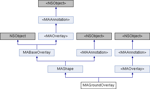
Inheritance diagram for MAGroundOverlay:
Instance Methods | |
| (CGFloat alpha) | - __attribute |
| 透明度. 最终透明度 = 纹理透明度 * alpha. 有效范围为[0.f, 1.f], 默认为1.f More... | |
| (BOOL) | - setGroundOverlayWithBounds:icon: |
| 更新GroundOverlay. since 5.0.0 More... | |
| (BOOL) | - setGroundOverlayWithCoordinate:zoomLevel:icon: |
| 更新GroundOverlay, 内部会自动计算覆盖物大小,以满足zoomLevel下显示大小为icon大小. since 5.0.0 More... | |
 Instance Methods inherited from <MAOverlay> Instance Methods inherited from <MAOverlay> | |
| (CLLocationCoordinate2D) | - coordinate |
| 返回区域中心坐标 More... | |
| (MAMapRect) | - boundingMapRect |
| 区域外接矩形 More... | |
| Instance Methods inherited from <MAAnnotation> | |
| (void) | - setCoordinate: |
| 设置标注的坐标,在拖拽时会被调用. More... | |
Class Methods | |
| (instancetype) | + groundOverlayWithBounds:icon: |
| 根据bounds值和icon生成GroundOverlay More... | |
| (instancetype) | + groundOverlayWithCoordinate:zoomLevel:icon: |
| 根据coordinate,icon,zoomLevel生成GroundOverlay More... | |
Properties | |
| UIImage * | icon |
| 绘制在地图上的覆盖图片 More... | |
| CGFloat | zoomLevel |
| 覆盖图片在地图尺寸等同于其像素的zoom值 More... | |
| MACoordinateBounds | bounds |
| 图片在地图中的覆盖范围 More... | |
| Properties inherited from MAShape | |
| NSString * | title |
| 标题 More... | |
| NSString * | subtitle |
| 副标题 More... | |
| Properties inherited from MABaseOverlay | |
| CLLocationCoordinate2D | coordinate |
| 返回区域中心坐标 More... | |
| MAMapRect | boundingMapRect |
| 区域外接矩形 More... | |
| double | altitude |
| 海拔,单位米,默认0 More... | |
| Properties inherited from <MAAnnotation> | |
| NSString * | title |
| annotation标题 More... | |
| NSString * | subtitle |
| annotation副标题 More... | |
| double | altitude |
| annotation海拔高度,单位米,默认0 More... | |
Additional Inherited Members | |
| Protected Attributes inherited from MAShape | |
| NSString * | _title |
| 标题 More... | |
| NSString * | _subtitle |
| 副标题 More... | |
| Protected Attributes inherited from MABaseOverlay | |
| double | _altitude |
| 海拔 More... | |
Detailed Description
该类用于确定覆盖在地图上的图片,及其覆盖区域, 通常MAGroundOverlay是MAGroundOverlayRenderer的model
Method Documentation
◆ __attribute
| - (CGFloat alpha) __attribute | ((deprecated("已废弃,since 7.7.0,请使用MAGroundOverlayRenderer中的alpha"))) |
透明度. 最终透明度 = 纹理透明度 * alpha. 有效范围为[0.f, 1.f], 默认为1.f
◆ groundOverlayWithBounds:icon:
| + (instancetype) groundOverlayWithBounds: | (MACoordinateBounds) | bounds | |
| icon: | (UIImage *) | icon | |
根据bounds值和icon生成GroundOverlay
- Parameters
-
bounds 图片的在地图的覆盖范围 icon 覆盖图片
- Returns
- 以bounds和icon 新生成GroundOverlay
◆ groundOverlayWithCoordinate:zoomLevel:icon:
| + (instancetype) groundOverlayWithCoordinate: | (CLLocationCoordinate2D) | coordinate | |
| zoomLevel: | (CGFloat) | zoomLevel | |
| icon: | (UIImage *) | icon | |
根据coordinate,icon,zoomLevel生成GroundOverlay
- Parameters
-
coordinate 图片的在地图上的中心点 zoomLevel 图片在地图尺寸等同于像素的zoom值 icon 覆盖图片
- Returns
- 以coordinate,icon,zoomLevel 新生成GroundOverlay
◆ setGroundOverlayWithBounds:icon:
| - (BOOL) setGroundOverlayWithBounds: | (MACoordinateBounds) | bounds | |
| icon: | (UIImage *) | icon | |
更新GroundOverlay. since 5.0.0
- Parameters
-
bounds 图片的在地图的覆盖范围 icon 覆盖图片
- Returns
- 返回是否成功
◆ setGroundOverlayWithCoordinate:zoomLevel:icon:
| - (BOOL) setGroundOverlayWithCoordinate: | (CLLocationCoordinate2D) | coordinate | |
| zoomLevel: | (CGFloat) | zoomLevel | |
| icon: | (UIImage *) | icon | |
更新GroundOverlay, 内部会自动计算覆盖物大小,以满足zoomLevel下显示大小为icon大小. since 5.0.0
- Parameters
-
coordinate 图片在地图上的中心点 zoomLevel 图片在地图尺寸等同于像素的zoom值 icon 覆盖图片
- Returns
- 返回是否成功
Property Documentation
◆ bounds
|
readnonatomicassign |
图片在地图中的覆盖范围
◆ icon
|
readnonatomicassign |
绘制在地图上的覆盖图片
◆ zoomLevel
|
readnonatomicassign |
覆盖图片在地图尺寸等同于其像素的zoom值
The documentation for this class was generated from the following file: